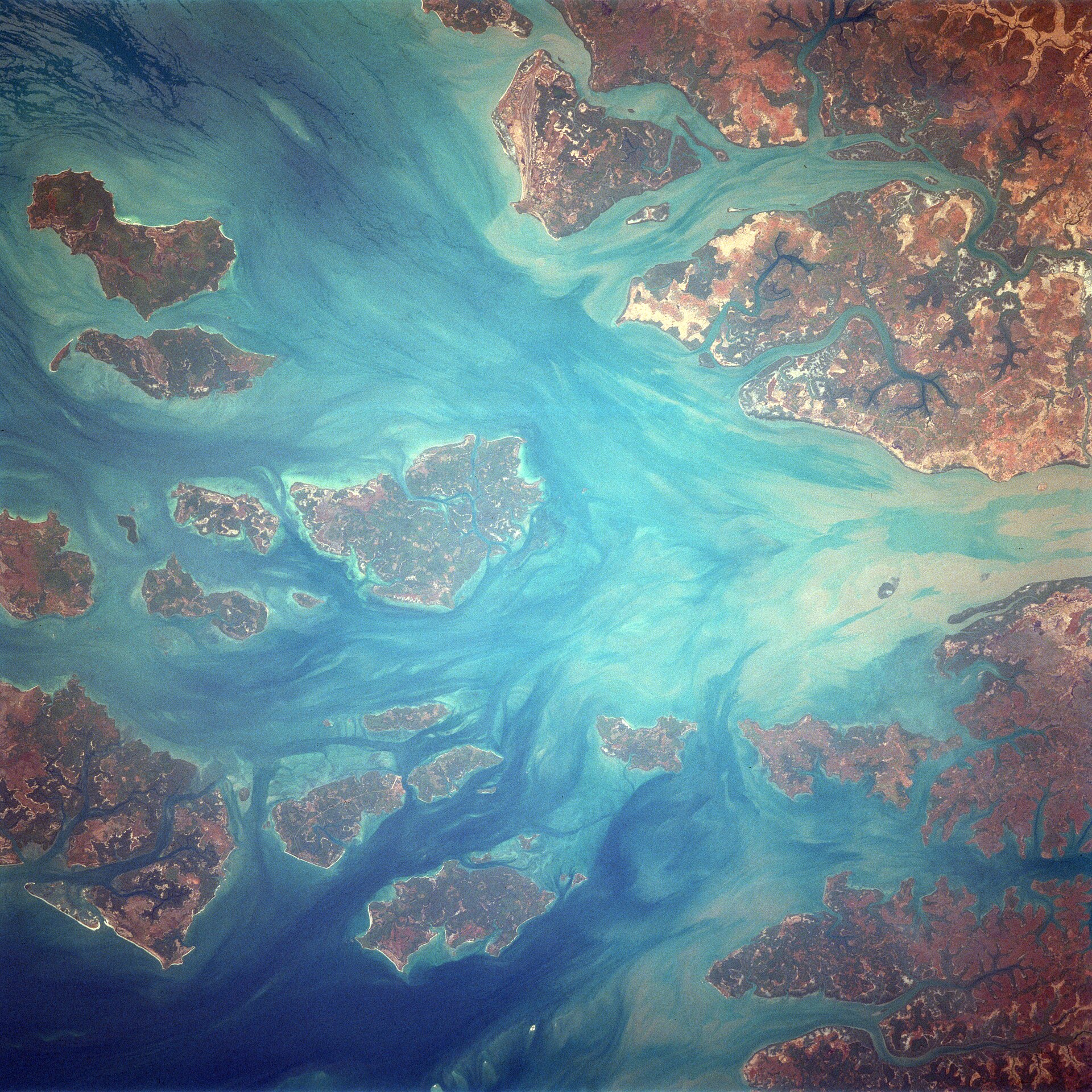
What UNESCO says
UNESCO describes the property in these words: “The property includes a continuous series of coastal and marine ecosystems, corresponding to the marine and intertidal environments of the best-preserved areas of the Bijagós Archipelago in Guinea-Bissau. The Archipelago is the only active deltaic archipelago on the African Atlantic coast and one of the few in the world. The site is home to a rich biodiversity, including endangered Green and Leatherback turtles, manatees, dolphins, and over 870,000 migratory shorebirds. It features mangroves, mudflats, and intertidal zones vital for marine life, and supports rare plant species, diverse fish populations, and bird colonies. Poilão Island is a globally important nesting site for turtles.”[1]
Background
The Bijagós are a group of about 88 islands and islets in the Atlantic off Guinea-Bissau. They formed from the ancient delta of the Geba and Grande de Buba rivers and cover 12,958 km².[2] Twenty of the islands are inhabited all year round. Bubaque is the most populated, and Bolama is the administrative capital.[2] The archipelago has mangroves, palm forests, dry forests and coastal savanna. It became a UNESCO Biosphere Reserve in 1996, and BirdLife International lists it as an Important Bird Area for waders, gulls, terns, flamingos and pelicans.[2]
The islands and the sea, as reported in 2025
France 24 reported in December 2025 that the archipelago has 88 islands and islets, about 20 of them permanently inhabited, over more than 10,000 square kilometres, with nearly 25,000 inhabitants. The island of Bubaque has nearly 5,000.[3]
The World Heritage site hosts colonies of sea turtles, hippos, sharks, manatees and nearly 850,000 migratory birds, as well as several sacred sites and artisanal fisheries.[3]
An official said the islands lose up to 2 metres of beach a year, while a government report says the coastline retreats up to seven metres a year. Residents spoke of a sea that was once far away, and UNESCO warned of a strong likelihood that climate change would bring erosion and changes in sea level.[3]
- The Bijagó people: their society, sacred sites and what they themselves say about protection of the islands. The article read here does not cover them.
- What the 2025 World Heritage listing changed for the islands.
- Local voices: none yet.
- The erosion figures differ between an official (up to 2 metres) and a government report (up to seven): neither has been checked here. The islanders' own accounts of the sacred sites and their life are mostly not covered by that report.
Sources
- Institutional[1] Coastal and Marine Ecosystems of the Bijagós Archipelago – Omatí Minhô. UNESCO World Heritage Centre, World Heritage List (open data, CC BY-SA 4.0). whc.unesco.org retrieved 7 Oct 2026
Read from UNESCO's open-data record (data.unesco.org, dataset whc001); the web page itself could not be opened from this project's tools. Texts are UNESCO's own. - Encyclopedia · to verify[2] Bijagós Islands. Wikipedia. en.wikipedia.org retrieved 7 Oct 2026
Used for background that the UNESCO record does not give. Each statement is limited to the article's lead and opening sections; confirm against specialist sources. - Press[3] Locals sound alarm as Bijagos Islands slowly swallowed by sea. France 24, 23 Dec 2025. www.france24.com retrieved 7 Oct 2026