What UNESCO says
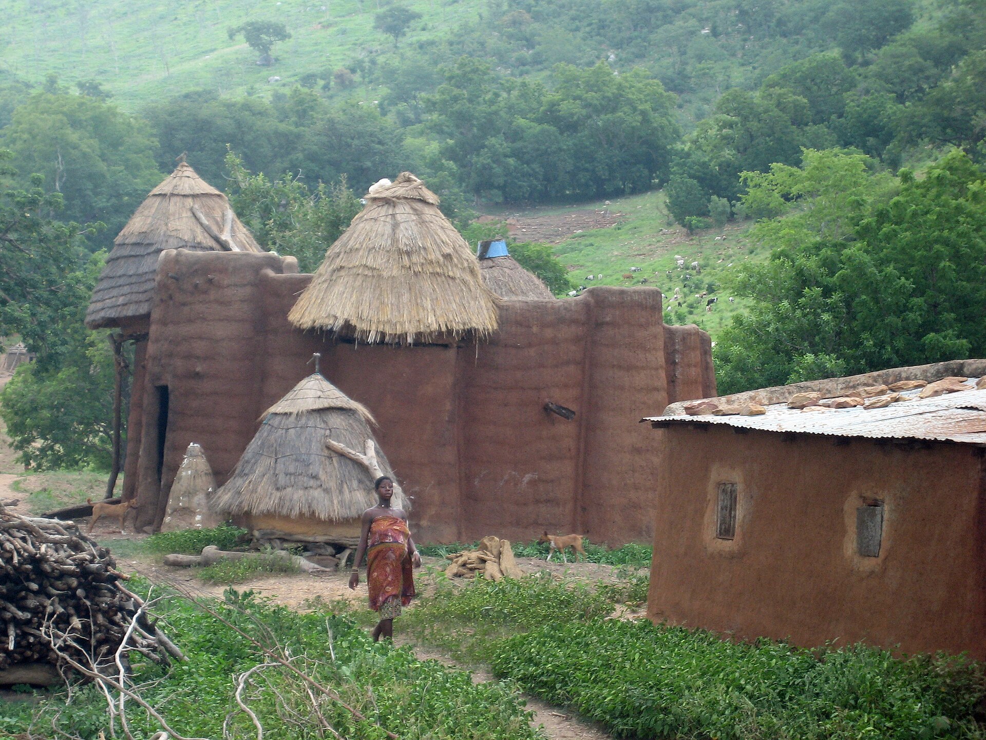
UNESCO describes the property in these words: “The Koutammakou landscape in north-eastern Togo and neighbouring Benin is home to the Batammariba, whose remarkable mud tower-houses are known as takienta (sikien in the plural). Nature is strongly associated with the rituals and beliefs of society here. The landscape is exceptional due to the architecture of the tower-houses which reflect the social structure; its farmland and forest; and the associations between people and landscape. The buildings are grouped in villages, which also include ceremonial spaces, springs, sacred rocks and sites reserved for initiation ceremonies.”[1]
Background
Koutammakou was designated in 2004 and expanded in 2023. It lies on the border between northern Togo and Benin, and its traditional mud tower-houses are still the preferred way of living.[2] Many of the houses have two floors, some have flat roofs, and Wikipedia says they are a national symbol of Togo.[2] In 2008 UNESCO's intangible heritage department set up a programme to safeguard the Batammariba's cultural heritage, to complete the inscription. It covers crafts, healing, building, dance, music, archery and oral traditions.[2]
- The Batammariba's own account of their architecture and its meaning. The article read here is not by them.
- What the 2023 expansion changed.
- Local voices: none yet.
Sources
- Institutional[1] Koutammakou, the Land of the Batammariba. UNESCO World Heritage Centre, World Heritage List (open data, CC BY-SA 4.0). whc.unesco.org retrieved 7 Oct 2026
Read from UNESCO's open-data record (data.unesco.org, dataset whc001); the web page itself could not be opened from this project's tools. Texts are UNESCO's own. - Encyclopedia · to verify[2] Koutammakou. Wikipedia. en.wikipedia.org retrieved 7 Oct 2026
Used for background that the UNESCO record does not give. Each statement is limited to the article's lead and opening sections; confirm against specialist sources.