What UNESCO says
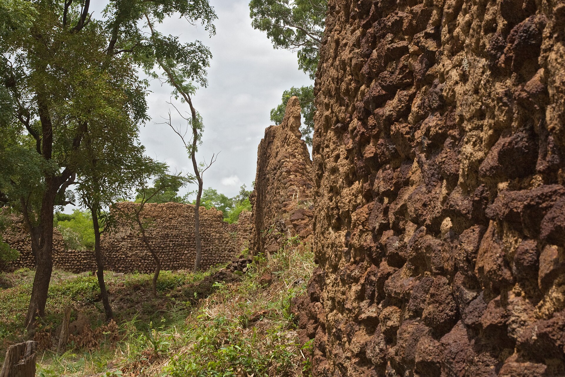
UNESCO describes the property in these words: “The 11,130m2 property, the first to be inscribed in the country, with its imposing stone walls is the best preserved of ten fortresses in the Lobi area and is part of a larger group of 100 stone enclosures that bear testimony to the power of the trans-Saharan gold trade. Situated near the borders of Côte d’Ivoire, Ghana and Togo, the ruins have recently been shown to be at least 1,000 years old. The settlement was occupied by the Lohron or Koulango peoples, who controlled the extraction and transformation of gold in the region when it reached its apogee from the 14th to the 17th century. Much mystery surrounds this site large parts of which have yet to be excavated. The settlement seems to have been abandoned during some periods during its long history. The property which was finally deserted in the early 19th century is expected to yield much more information.”[1]
What researchers are finding
The site covers nearly 10,000 square metres and is surrounded by tall stone walls, according to a CNRS photo series from 2017.[2] The earliest inhabited levels are believed to date from a period running from the 11th to the 15th centuries.[2] The purpose of the ruins is still not fully understood. The page says they may relate to the region's gold mines, which have been worked since about 1000 AD.[2] The research is part of the Lobi-Or-Fort project, which combines archaeology, geophysics, anthropology, geochemistry and 3D modelling, and plots finds on a grid across the site.[2]
- Who built and used the enclosure. The sources found say only that the purpose is not fully understood; the people attributed to it (Lohron, Koulango) are named in Wikipedia and UNESCO texts that have not been read here.
- The published results of the Lobi-Or-Fort project, beyond a photo caption.
- The living communities around the ruins and what they say about the place.
- Local voices: none yet.
Sources
- Institutional[1] Ruins of Loropéni. UNESCO World Heritage Centre, World Heritage List (open data, CC BY-SA 4.0). whc.unesco.org retrieved 7 Oct 2026
Read from UNESCO's open-data record (data.unesco.org, dataset whc001); the web page itself could not be opened from this project's tools. Texts are UNESCO's own. - Institutional · to verify[2] Loropéni and the forts of the Lobi region (Lobi-Or-Fort project). CNRS Images, photographs by Fabrice Monna (2017). images.cnrs.fr retrieved 7 Oct 2026
Caption text of a CNRS photo series on the Lobi-Or-Fort research project. Read through a page summary; confirm against the project's publications.